-
Earth Science Journal
Journal #22: Air Masses and Weather Fronts!
For this activity, you will need your journal, reference tables, and colored pencils/crayons.
Please write down this definition.
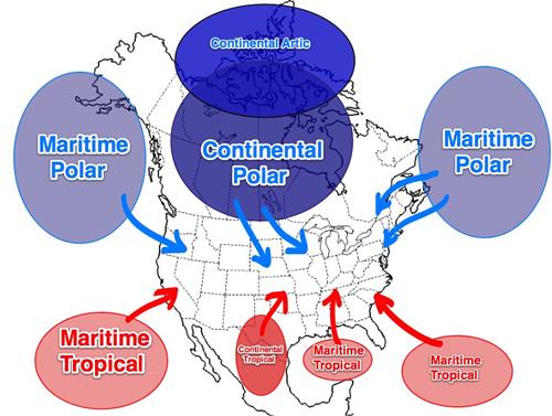
1. Air Mass is a giant bubble of air similar in temperature and humidity to the surface it forms above.
2. Air masses moving across our country and interacting bring us our weather.
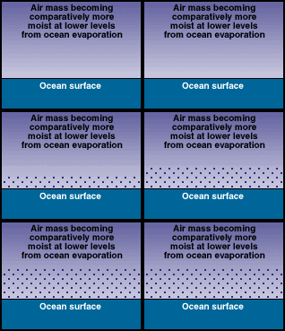
Continental: (formed over land) = dry
Maritime: (formed over water) = humid
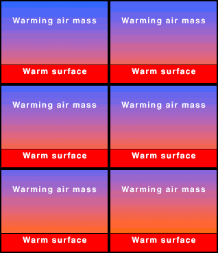
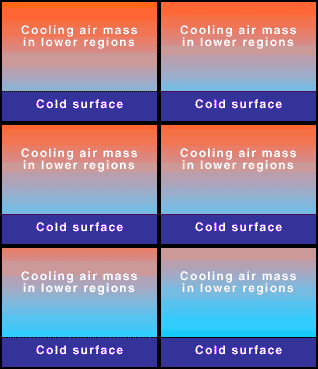
Tropical: (formed near equator) = hot
Polar: (formed near poles) = cold
ContinentalMaritimeTropicalPolar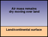
 3. Air masses take the characteristics of the surface they're over.For example, if the air mass is over Canada, it would be continental polar.
Continental Arctic (cA)- very dry; very cold
Continental Polar (cP) - dry & cold
Continental Tropical (cT) - dry & warm
Maritime Tropical (mT) - humid & warm
Maritime Polar (mP) - humid & cool
Remember your reference tables!
Page 13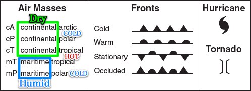
Write this in your reference tables!
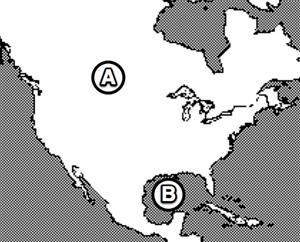
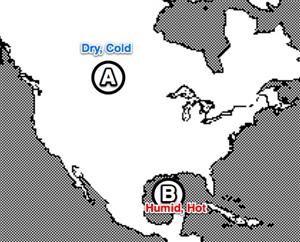
4. In the diagram above, locations A and B on the map of North America are source regions for air masses. Compared to the air mass formed at location B, the air mass formed at location A will be Cooler and drier.
5. Which abbreviation indicates a warm air mass that contains large amounts of water vapor? mT
6. An air mass classified as cP usually forms over which type of Earth's surface? Cold land
7. The characteristics of air masses depend chiefly upon the Surface where the air mass originally formed.
Weather Fronts!
Cold Front
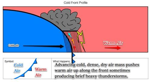
Where is the cold air?8. Cold Front: Brings brief heavy rains, cooler, dry air, and clear weather.
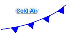
The cold air is behind the cold front.
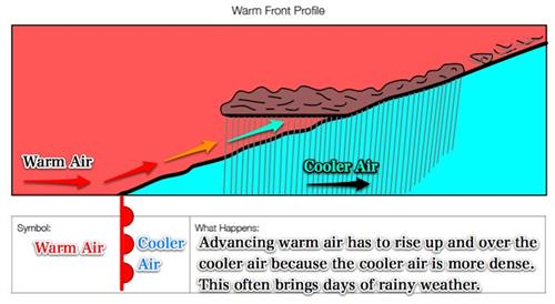
Warm FrontWhere is the warm air? 9. Warm Front: Warmer, humid air but can bring days of rainy weather

The warm air is behind the warm front.Think of the half circles as sunrises.
Stationary front
Which side of the front is the warm and cold air?
10. Stationary front: Several days of cloudy, wet weather can last a long time (sometimes for weeks!)

The cold or warm air is on the opposite side of the front symbol.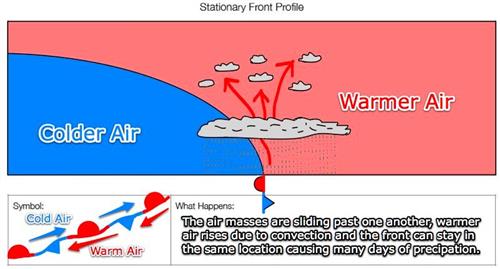
Occluded front

11. Occluded front: When warmer, less dense air is lifted over the cooler air mass.
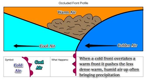
Here, it is going in the other direction.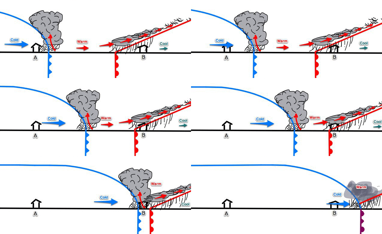
Drawing Front ProfilesDraw the following front profiles between moving in the correct direction.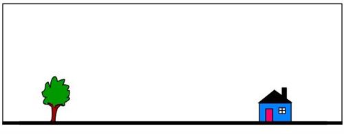
12. Draw a cold front moving toward the house.*Cold fronts have a very steep interface (boundary).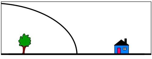 What type of air mass do you think is behind a cold front?
Continental Polar (cP).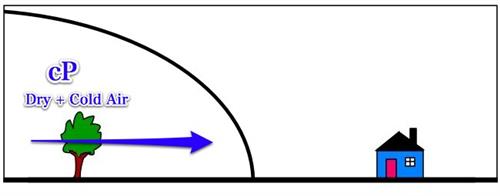
13. What type of air mass do you think is in front of a cold front?Maritime Tropical (mT).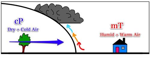
14. What will happen to the mT air as the cold front approaches the house?
The mT air mass is forced up quickly.
15. What will that bring to the house?Possibly Thunderstorms!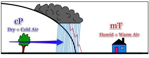 16. What else might this type of front bring?
Possibly tornadoes!Could you draw a cold front moving in the opposite direction?Could you label the air masses and show where precipitation will happen?That would make for a good test question!
Draw a warm front moving toward the house.
*Warm fronts have a very low-angle interface.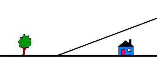 17. What type of air mass do you think is behind a warm front?Maritime Tropical (mT).
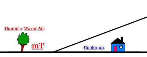 18. What will happen along with the frontal interface?
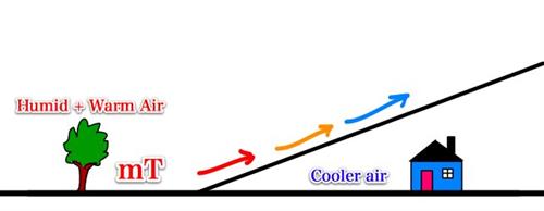
19. The warmer, humid air rises over the cooler, drier, more dense air.The warmer air cools due to adiabatic expansion as it rises.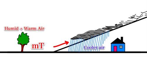 What will that cause?Precipitation
Could you draw and label a warm front moving toward the tree?
Could you label the air masses and weather front and draw where precipitation occurs?Another good test question!Explaining Weather FrontsKnow this!
20. Why do clouds and precipitation form along weather fronts?
1. Less dense air rises
2. Rising air expands and cools due to less air pressure.
3. Air reaches the dew point temperature
4. Water vapor condenses onto dust (condensation nuclei) and makes clouds (water droplets).
5. Cloud droplets collide to become big enough to fall as precipitation.
What type of weather front is being formed here?
 21. When a cold front overtakes a warm front, it forms an occluded front.
The current weather right now.What do you notice?Can you find all four types of weather fronts?
You may want to print some of the images below to include in your journal.
Could you label these fronts below?
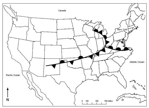
Answer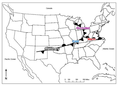
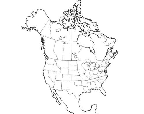
Draw the fronts on this map.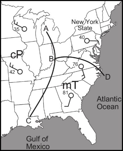 There are three fronts.Make sure to get the symbols on the correct side of the front.
Answers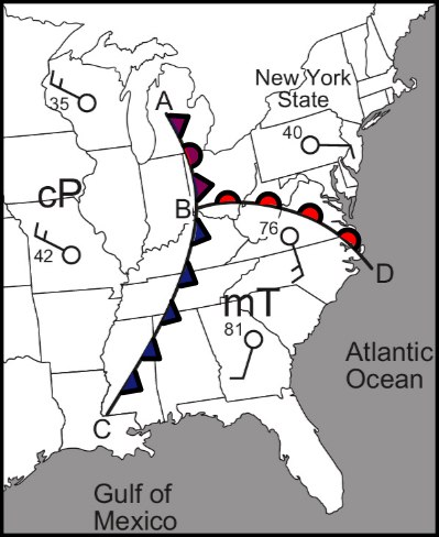
22. What should you wear to protect yourself from lightning?
23. Why are you safe in a car during lighting?
Reflection
Explain how air masses cause weather fronts and why weather fronts often bring precipitation.
Regents Earth Science Core Curriculum
2.1h Atmospheric moisture, temperature, and pressure distributions; jet streams, wind; air masses, and frontal boundaries; and the movement of cyclonic systems and associated tornadoes, thunderstorms, and hurricanes occur in observable patterns. Loss of property, personal injury, and loss of life can be reduced by effective emergency preparedness.
2.1e Weather variables are interrelated. For example, • temperature and humidity affect air pressure, and the probability of precipitation • air pressure gradient controls wind velocity.


